AN
OLD MAP
OF THE
WESTERN GEORGIAN PROVINCE
OF
IMERETI
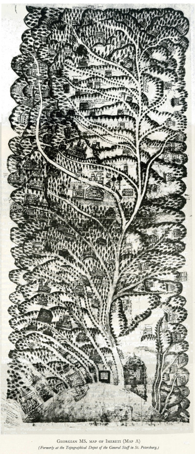
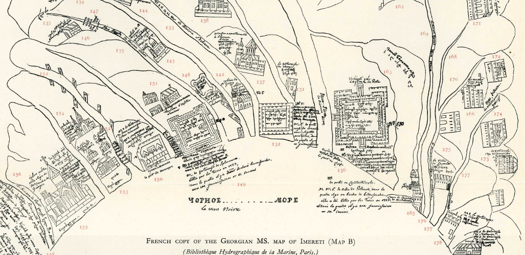
The following map was published in an article the great W.E.D. Allen himself contributed to Vol. X (1953) of Imago Mundi—a review of early cartography edited by Leo Bagrow and published in Stockholm. (Although the title of Allen's article is "Two Georgian maps of the first half of the eighteenth century", the two maps are essentially two versions of the same—"Map B" being far superior in terms of clarity to the original "A".)
The map covers a vast area of western Georgia, stretching far beyond the borders of what most people would recognize as constituting the Georgian province of Imereti, and extends inland from the Black Sea i.e. towards the east. The first building to the NW (bottom-left-hand corner) is the cathedral of Bichvinta (no. 155); clockwise, the next limits are:—to the NE (top-left-hand corner), the castle of Modamnake (67);—to the SE (top-right-hand corner), the monastery of Nunisi (89);—and to the SW (bottom-right-hand corner), the town of Batumi (179).
The map was drawn according to the main rivers of Western Georgian and their tributaries, viz. the Rioni and its affluents, the Tskhenis-Tsq'ali (literally "Horse-water"), the Kvirila and its affluents, the Tsitela, the Dzirula and its affluents, the Tekhuri, the Kodori (of Gorge fame), &c.
Also marked are (in no particular order) Poti, Kutaisi and Gelati, Sokhumi, Sachkhere, Ozurgeti, parts of Racha (Ghebi, Glola), the road to Svaneti, Katskhi (of Stylite-column fame), Khargauli, Nikortsminda, Shorapani, Tsageri, &c.

|
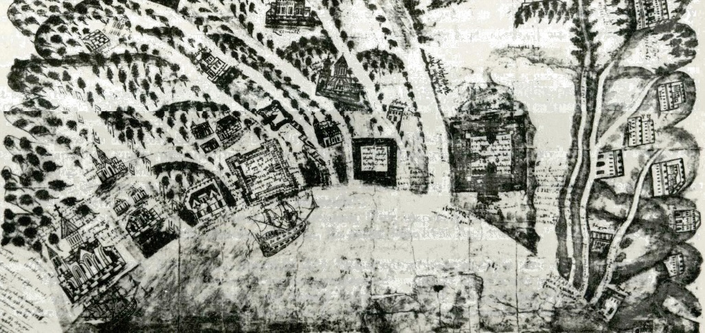
The same detail of the Black Sea coast—charming above, and detailed to the right. The large church on the left is Bitchvinta; the largest of the squares (right of centre) is Poti. |
|
|---|
In his article, and following a brief introduction to the map's history, Allen embarks upon an extremely detailed seventeen-page "Comparison of the Alexander maps with Wakhusht's Description of Imereti." In typical fashion, over half of Allen's article consists of footnotes, which sometimes occupy as much as ⅘ths or sometimes even ⅚ths of a page; their remarkable length is entirely due to the author's extraordinary (some might say downright bloody-minded) erudition and scholarship.
Allen's article is highly recommended reading for all those interested in the hydrological, historical and architectural geography of Western Georgia. (My copy of Vol. X of Imago Mundi was purchased on the "Abebooks" website.)
Unless stated otherwise, all materials on this website are © A.J.T.Bainbridge 2006-2014
Get in touch! Gmail: alexjtb


